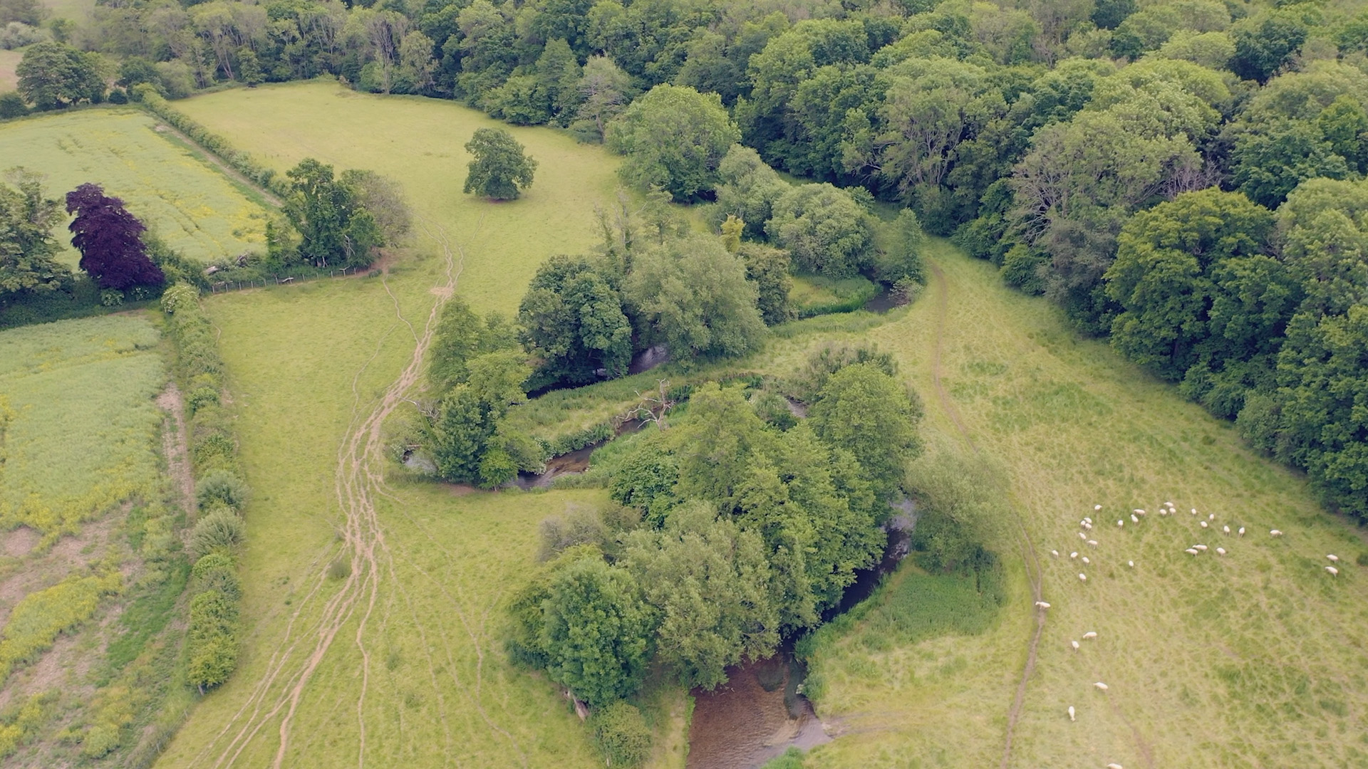
Meadows of Farnham is a moving image project exploring the intersection of people and nature in rural Surrey, England. It places early maps in conversation with drone visualisations to follow the course of the river Wey and its adjacent water meadows near the small town of Farnham.
The project pivots on one of the most significant historical changes underpinning the agricultural management of the countryside - the process of enclosure or consolidation of fields to single ownership.
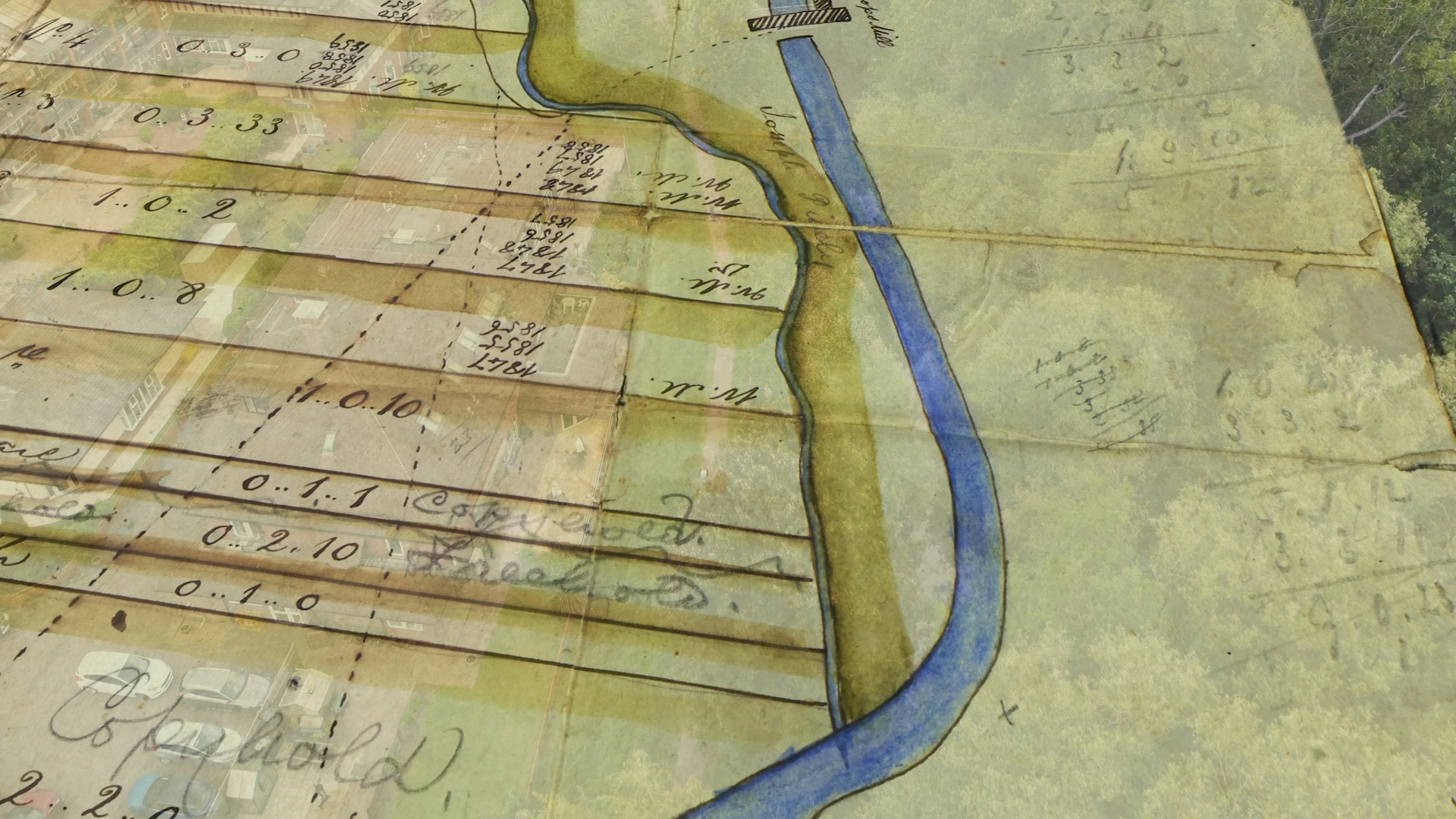
As an experiment, the project superimposes estate maps fromo 1796 and 1811 showing the palimpsest written within the meadows as captured by the drone. Whereas the shape of the lives of these landowners and tenants may be lost to us, the representation offers a vision of the relations of production of agriculture then onto the landscape of today.
The drone visualisation in Meadows of Farnham is a contentious means of visual productions in academia. Critics point to the use of drone by western militaries for the projection of power and control. Counter examples are available - discussed by Choi-Fitzpatrick - this work adopts this technology to tell a community narrative.